Take a stroll through Franklin Parks’ late 1800s and early to mid-1900s Streets
Atlantic Street, 1929. (If you recognize the home on the center left side of the photo, please let us know, so that we can try to identify where on Atlantic this photo was taken.)
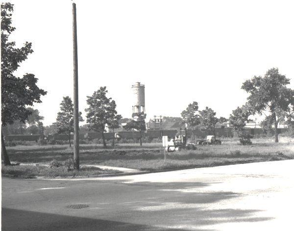
A view southwest from the intersection of Belmont and Edgington.
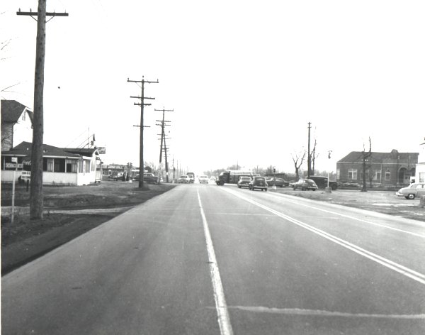
Belmont Ave. looking east from just west of the railroad tracks (near Washington St.)
The intersection of Belmont Ave., Rose St. and Pacific Ave. The photograph is taken from just east of Rose street, looking west down Pacific Ave. (Belmont Ave. continues on the other side of the railroad tracks.)
Chestnut St. east from Atlantic Ave. This is pre-Passow elementary school, when Hester Jr. High was called Main School. (Main School would be near the center right hand side of the photo where the fence is.)
The intersection of Dora St. and Lesser St. (Maybe someone will recognize the homes in the photo and let us know which direction the view is…)
An early view of Mannheim Rd. We are looking north of Franklin Ave. Bosenberg’s store is in the center left of the photograph.
This is another early view of Mannheim Road looking south. The Zimmerman home (on the left hand side of the photo) was on the northeast corner of Gage and Mannheim.
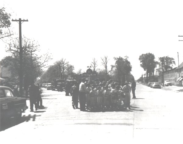
Franklin Ave. looking west from Rose St. – looks a little different than today. Vacant lots, absence of some buildings and differences in existing buildings. Notice the dirt road, absence of street lights (except the fixture suspended over the intersection).
A little more modern view of Franklin Ave. west of Rose St. You can see our town beginning to emerge. Franklin Ave. is still not paved.
A still more modern view of Franklin Ave. There is still an absence of some buildings and a few buildings in the photo no longer stand. Street lights and a paved road, however, now exist.
An opposite view of Franklin Ave. from Calwagner Ave. (looking east). Again, the streets are not paved. Notice the beautiful bay windows and turrets which adorn the building on the northeast corner (these have been removed over the years).
A later photograph of Franklin Ave. This time we are looking west from east of Calwagner Ave. Franklin is now paved. The turrets have been removed from the building on the northeast corner, however the bay windows are still attached. (The bay windows have been removed since this photo was taken.)
Another very early view of Franklin Ave. looking west from approximately Pearl St. Notice the old water tower, some early shops along the avenue and the hitching post.
This photograph shows Fullerton Ave. where Silvercreek crosses the street (approximately at Ruby St.). Obviously it was taken after a rainstorm where there was probably some flooding in the area; note the discarded rolls of carpeting lying on Fullerton.
We are looking north along Grand Ave. from just south of Mannheim Rd. On the northwest corner the Grand Manor Restaurant is shown. On the northeast corner is a picnic grove.
This view is of the intersection of Grand Ave. and Mannheim Rd. from the opposite direction. We can see the very corner of the Grand Manor (northwest corner), the picnic grove (northeast corner), the old Mannheim School (southwest corner) and The Grand Grill (southeast corner).
The Grand Ave. bridge that crosses the Des Plaines River into River Grove, IL. This was a time when the water in the river was a lot cleaner. (note the people wading in the river).
When Grand Ave. was a little narrower. The view is looking west down Grand Ave. from approximately Edgington St.
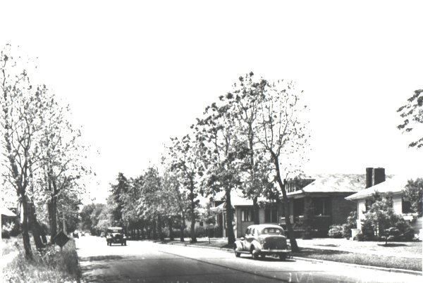
This photograph was taken in 1949, although it is a typical scene that could have been today or yesterday. It is looking east on Grand from east of Emerson St.
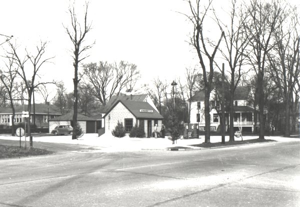
This photograph shows Grand Ave. looking west from just east of Mannheim Rd. On the left of the photograph, you can see the very edge of Mannheim School (southwest corner). On the middle right you can see Grand Manor Restaurant (northwest corner). Just beneath the Grand Manor you can see a gas station (northeast corner).
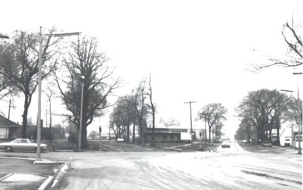
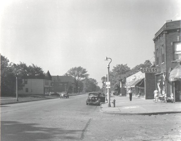
A view of Grand Ave. looking west from Rose St. Do you remember the A.& P.? How about Peter’s Pizzeria? You can see the signs for each of them near the center of the photograph.
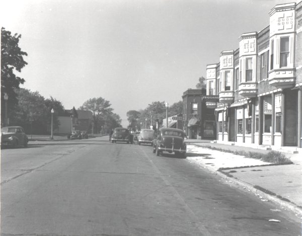
Another view of Grand Ave. looking west from Scott St. This shows another time in Franklin Park’s history. Notice the Sunset Arms Hotel and the Kroeger Foodstore (neither of which still exists). Also, notice how barren the land is west of Kroeger.
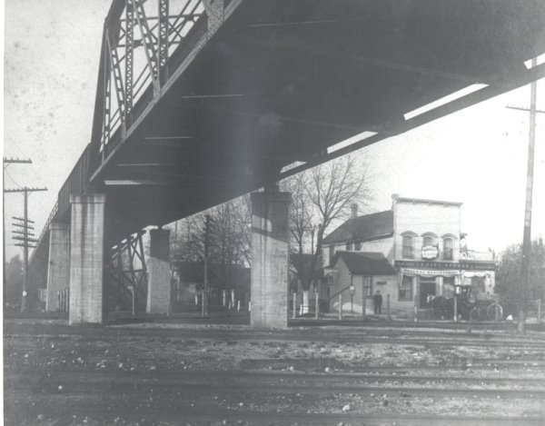
A very early forerunner of the current Mannheim bridge. In front of Fritz Pfundt’s store (on Franklin Ave. just east of the bridge) a horse and carriage awaits its owner.
We are now on Mannheim Rd. approaching the bridge. The date is 1948. The problem is, we are not sure which direction we are on Mannheim Rd. If anyone recognizes any of the buildings, please let us know.
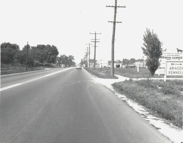
The view is north along Mannheim Rd. from near Chestnut St. This is pre-hotel days. Do you remember the Aragon Kennels?
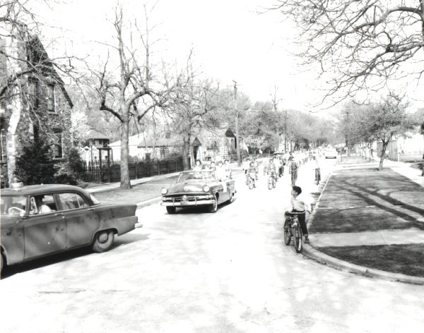
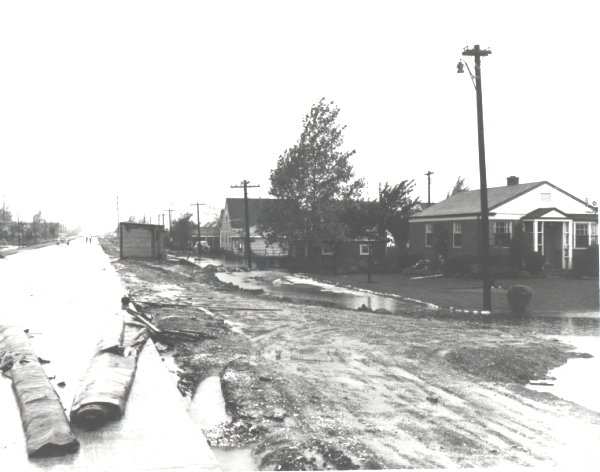
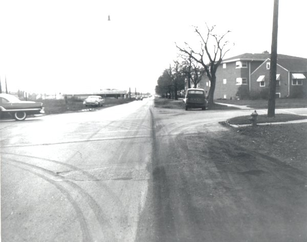
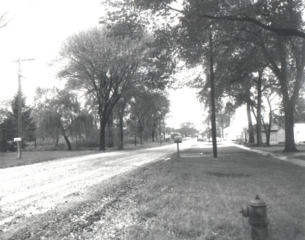
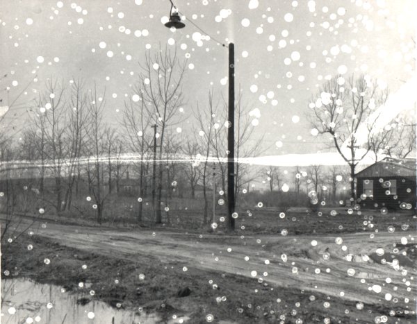
It’s rainy season again in Franklin Park. This photo is looking north along Hawthorne St. from the 2600 block.
This photo is from pre-pool days. We are looking west along Pacific Ave. from Calwagner Ave. (the Franklin Park Pool would be on the southwest corner.)
Pacific Ave. near Dora St. before curbs were put in.
Park Ave. looking west from Willow St. Notice that Park Ave. is still a dirt road with a lot of empty lots surrounding it.
Rose St. entering Franklin Park. If you recognize any of the homes, let us know. We can then determine a little more precisely where on Rose St. this photo was taken.
The intersection of Rose St., Pacific Ave. and Belmont Ave. Rose St. runs across the bottom of the photograph. Pacific Ave. is near the center left of the picture. Belmont Ave. would enter on the right hand side of the photograph if the field of vision were a little greater.
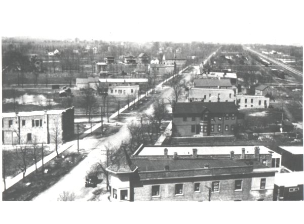
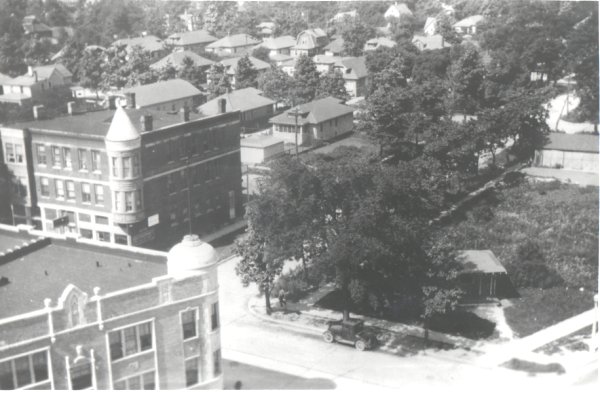
Looking down on Rose St. with Minneapolis St. running up from the center of the photo. The Franklin Park hotel is on the southwest corner of Rose and Minneapolis. In the very bottom right corner of the photo is Franklin Ave. Notice the southwest corner of Franklin Ave. and Rose St. is a vacant lot, with the exception of the small building located near Rose St. The cupola on the the top of the Puglia building has not been removed (southeast corner of Franklin and Rose).
We are now on the south side of the railroad tracks where Ruby St., Pacific Ave. and Belmont Ave. intersect. Across the bottom of the photograph is Ruby St. The right side of the photo shows Pacific Ave. looking west from Ruby St.. The left side of the photo shows Belmont Ave. looking west from Ruby St.
The intersection of Sarah St. and Lesser St. Does anyone recognize any of the homes in the photograph, so we can determine which direction the view is from?
When Scott St. and Fullerton Ave. were dirt roads. Fullerton Ave. runs across the center of the photo from the left side to the right side. From just beneath Fullerton, on the right side, crossing over and just above Fullerton Ave., on the left side of the photo, is Scott St.
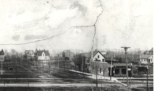
Across the bottom of the photograph is Franklin Ave. From the center-bottom of the photo toward the left-center of the photograph, between the rows of trees, is Washington St. Aug Linn tavern is in the bottom right corner of the photograph and Dr. Burke’s home can be seen in the distance, down Washington St.
Although many people may assume that Rose St. was one of the first paved roads in Franklin Park, the first two paved streets in Franklin Park were actually Franklin Ave. and Edgington St.
How Our Streets Were Named
Alcoa: Alcoa Casting
Bismark: German statesman (Otto von Bismark)
Britta, Davis, Iona, Nerbonne, Nichols: Salesmen & members of the Lonnquist family
Calwagner: Salesman for Lesser Franklin
Copenhagen: Predecessor to U.S. Tobacco
Dodge: Dr. Harold Dodge
Dora: Lesser and Sarah Franklin’s daughter
Edgington: Lesser and Sarah Franklin’s son
Emerson: American essayist (Ralph Waldo Emerson)
Ernst: Ernst Pflug, pioneer settler
Franklin: Lesser Franklin family
Gage: Frank Gage (Lesser Franklin’s staff)
George: Lesser Franklin’s office boy
Gustave: Lesser and Sarah Franklin’s son
Hirschberg: One of Franklin’s salesmen
Ivanhoe: The literary character
King: Peter King (brother of Sarah Franklin, Lesser Franklin’s wife)
Kirchhoff: Henry Kirchhoff, pioneer family
Latoria: Latoria family
Lesser: Lesser Franklin, founder of Franklin Park
Leyden Court: Leyden, Holland
Lincoln: U.S. President Abraham Lincoln
Lonnquist: Axel Lonnquist, developer
McNerney: William McNerney, Franklin Park Village President
Mannheim: Manheim, Germany
Martens: Charles Martens, first Village President
Minneapolis: Minneapolis, Minnesota (birthplace of G.K. (Gustav) Franklin)
Pearl: Lesser and Sarah Franklin’s daughter
Reeves Court: Barney Reeves, Franklin Park Village President
Rose: Lesser and Sarah Franklin’s daughter
Ruby: William Ruby, Lesser Franklin’s staff
Runge: Runge Paper
Sarah: Lesser Franklin’s wife
Schierhorn Court: Christian Schierhorn, pioneer settler
Schiller: German poet (Johann Christoph Friedrich Schiller)
Scott: English poet (Sir Walter Scott)
Silvercreek Drive: The Creek
Washington: U.S. President George Washington
Williams: Jack Williams, Franklin Park Village President


 Upcoming Events